- Fisiologia vegetale - Il sistema immunitario delle piante
- Bioeconomia, Chemiurgia & Green Economy
- Invecchiare
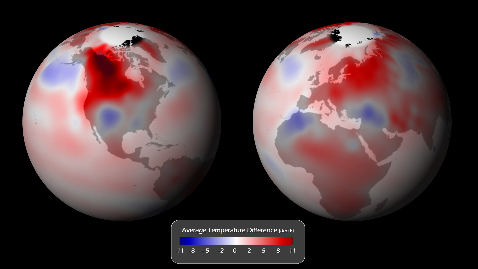
FAO - Observing Deforestation from Space
 |
|  |
| 
Using a remote sensing surveying technology, FAO has taken and analysed more than 13,500 high-resolution satellite images in 102 countries. These images will help nations to accurately assess the state of their forests. Monitoring change in forests has important implications for biodiversity conservation, carbon storage and human livelihoods. The losses in forests all around the world can now be quantified for the first time, FAO announced at the U.N. 17th Conference of the Parties climate change summit, which is taking place from Nov. 28 to Dec. 9 in Durban, South Africa.
“It’s a very comprehensive study of the world’s forests. For the first time we have consistent and comparable global and regional long-term data on forest loss land use. Up until now, most available data has come in numbers, not maps (based on satellite images),” explained FAO forest monitoring scientist Adam Gerrand. (...)
The article:
http://www.ips.org/TV/cop17/observing-deforestation-from-space/
From FAO website:
http://www.fao.org/news/story/en/item/95180/icode/
A FAO Report:
http://foris.fao.org/static/data/fra2010/RSS_Summary_Report_lowres.pdf
Sull'argomento:
http://www.greenreport.it/_new/index.php?page=default&id=13499


| < Prec. | Succ. > |
|---|

 Survival: La lotta contro il riscaldamento globale devasta i popoli indigeni
  Copenhagen meno 30

 |